BUFFALO TRACE 2.0
Scale: 1 in = 20 ft
Nov 2024 - Dec 2024
ArcGIS, Autocad, Adobe Illustrator, Adobe InDesign
LA 250 Environmental Site Analysis
Individual Work
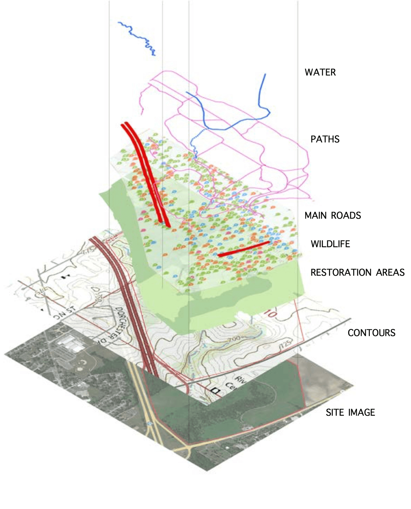
Buffalo Trace Prairie is a preservation site for prairie and forest lands. There are several waterways and trails running through Buffalo Trace. Through detailed site analysis, each proposed design for Buffalo Trace has minimal disturbance on the site, and are located strategically.
BUFFALO TRACE PRAIRIE, MAHOMET, ILLINOIS
Site of Buffalo Trace. The red paths are existing pathways, and the blue paths are waterways. The darker green areas are forest land, and the lighter green areas are prairie land. The proposed elements are a viewing deck, an outdoor education space, and an outdoor pavilion.


EDUCATION AREA
The education space is close to the east parking lot for easy access, but not too close to the road to ensure safety. It is also close to waterways, allowing for more education opportunities and exploration.
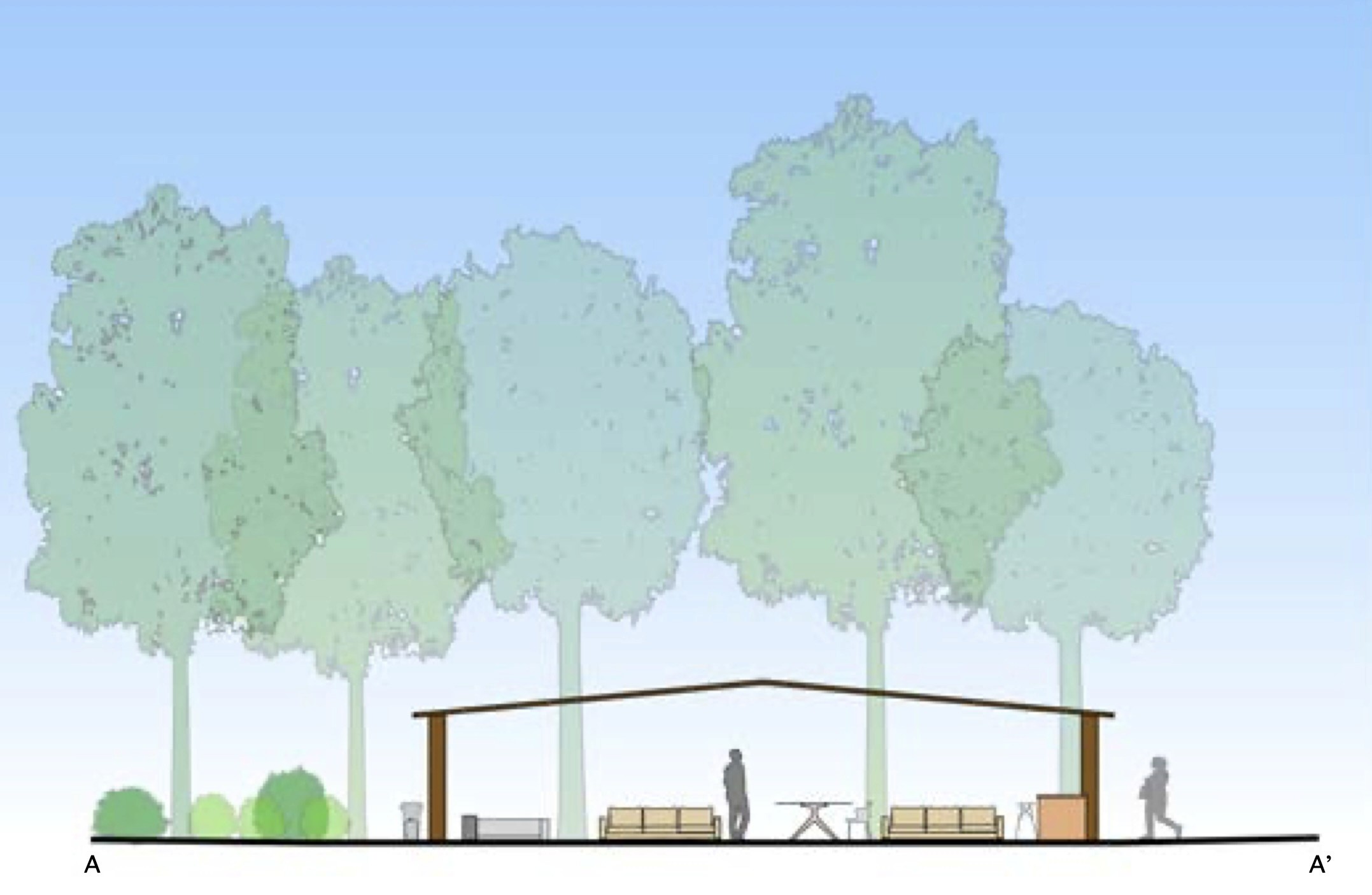
PAVILION
The pavilion is also close to the east parking lot and pathways for easy access. There are no artificial lights or grills to ensure minimal disturbance.


VIEWING DECK
The viewing deck is placed at the highest elevation point of the site, which is about 775 ft. It is accessible by the existing pathways.


BUFFALO TRACE 2.0
BUFFALO TRACE PRAIRIE, MAHOMET, ILLINOIS
Scale: 1 in = 20 ft
Nov 2024 - Dec 2024
ArcGIS, Autocad, Adobe Illustrator, Adobe InDesign
LA 250 Environmental Site Analysis
Individual Work
Buffalo Trace Prairie is a preservation site for prairie and forest lands. There are several waterways and trails running through Buffalo Trace. Through detailed site analysis, each proposed design for Buffalo Trace has minimal disturbance on the site, and are located strategically.
Site of Buffalo Trace. The red paths are existing pathways, and the blue paths are waterways. The darker green areas are forest land, and the lighter green areas are prairie land. The proposed elements are a viewing deck, an outdoor education space, and an outdoor pavilion.
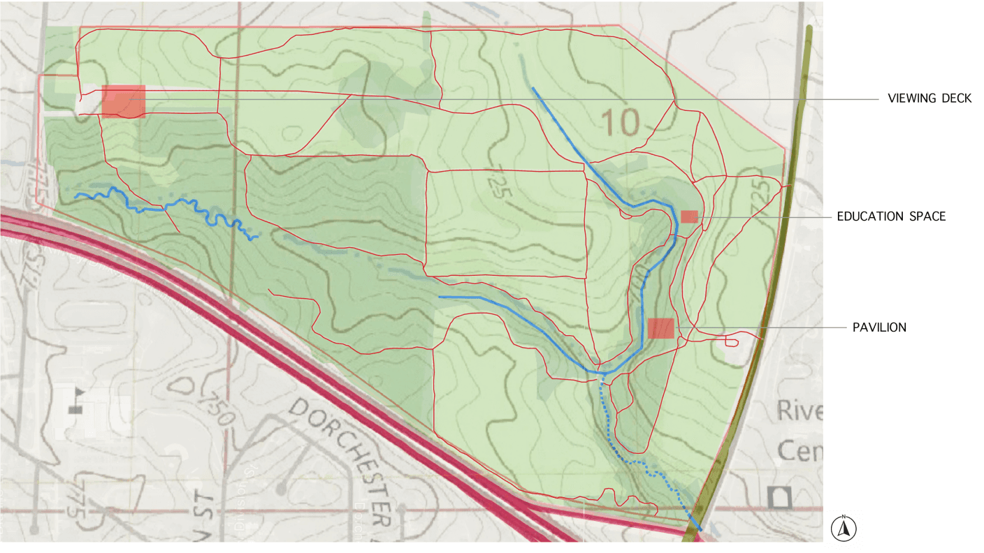
EDUCATION AREA
PAVILION
VIEWING DECK
The education space is close to the east parking lot for easy access, but not too close to the road to ensure safety. It is also close to waterways, allowing for more education opportunities and exploration.
The pavilion is also close to the east parking lot and pathways for easy access. There are no artificial lights or grills to ensure minimal disturbance.
The viewing deck is placed at the highest elevation point of the site, which is about 775 ft. It is accessible by the existing pathways.